


Atmosphere 2024, 15(5), 543; https://doi.org/10.3390/atmos15050543 (registering DOI) - 28 Apr 2024
Abstract
In East Asia, where concentrated summer precipitation often leads to climate disasters, understanding the factors that cause such extreme rainfall is crucial for effective forecasting and preparedness. The western North Pacific subtropical high (WNPSH) is a key driver of summer precipitation variability, and
[...] Read more.
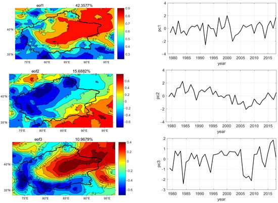
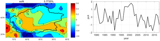
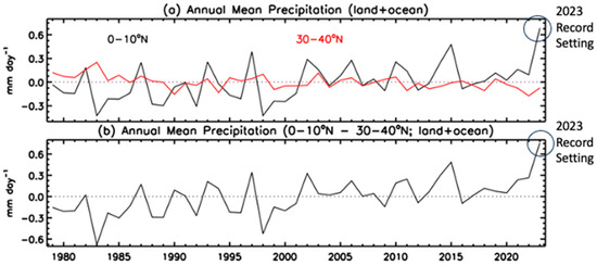
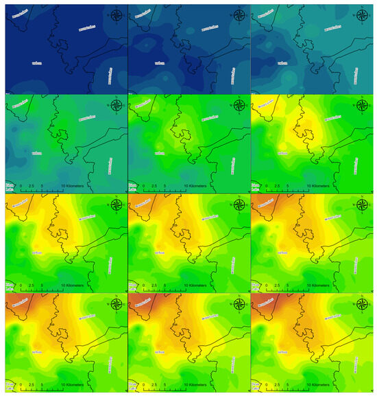
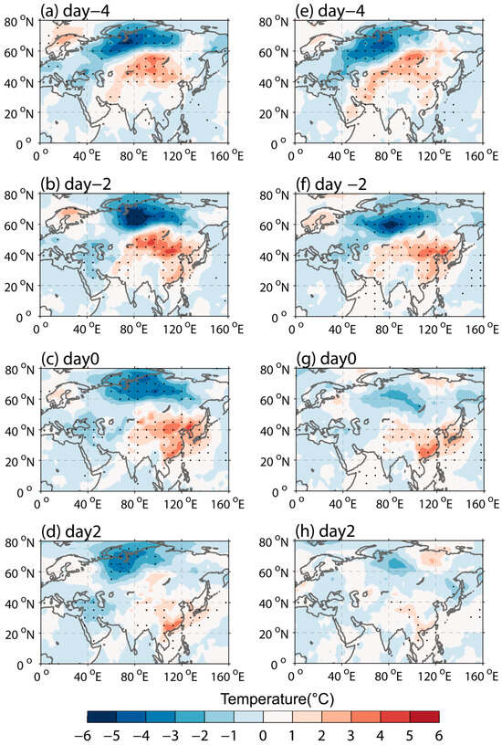
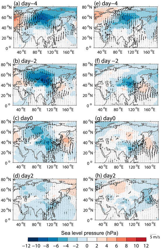
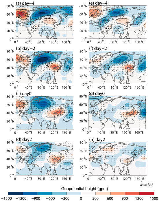
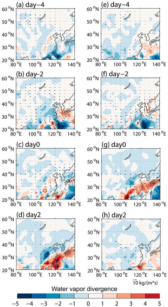
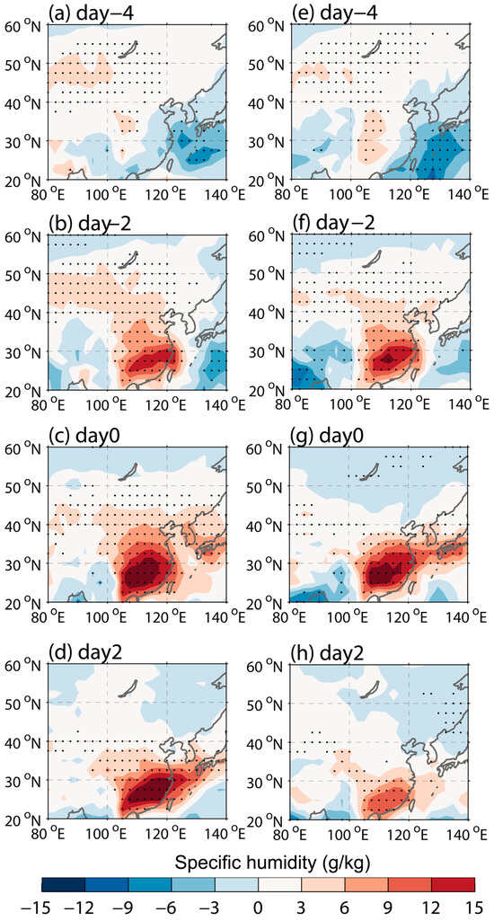
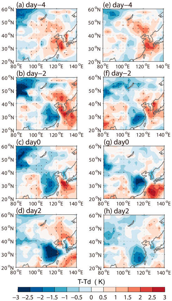
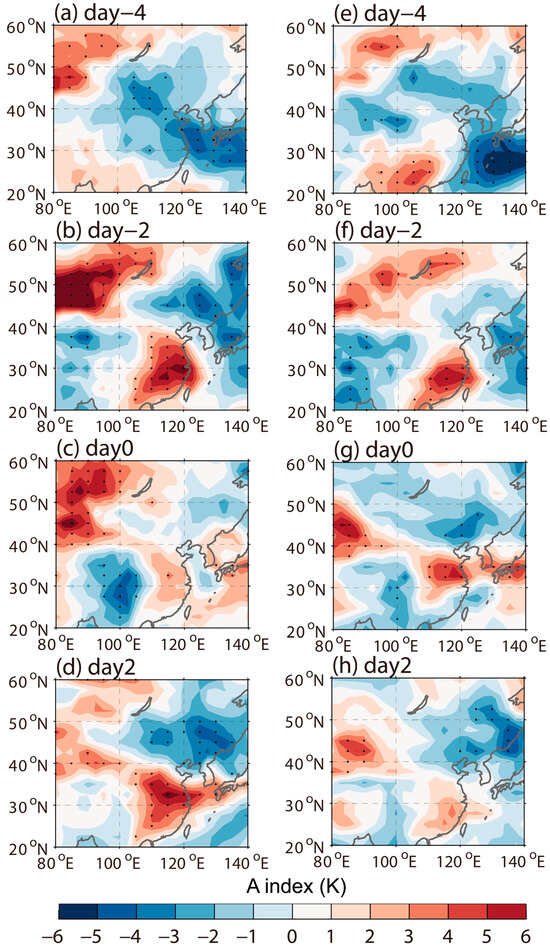
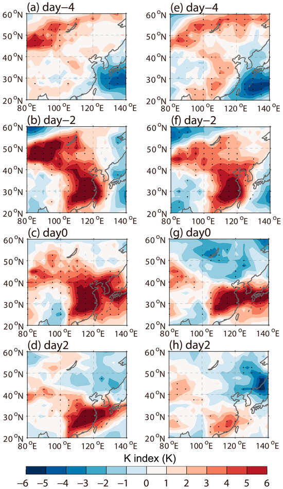
In East Asia, where concentrated summer precipitation often leads to climate disasters, understanding the factors that cause such extreme rainfall is crucial for effective forecasting and preparedness. The western North Pacific subtropical high (WNPSH) is a key driver of summer precipitation variability, and therefore, its monitoring is critical to predicting the wet or dry periods during the East Asian summer monsoon. Using the Geo-KOMPSAT 2A (GK2A) satellite cloud amount data and ERA5 reanalysis data during the years 2020–2023, this study identified three leading empirical orthogonal function (EOF) modes and investigated the associated WNPSH variability at synoptic and subseasonal scales. The analysis includes a linear regression of meteorological fields onto the principal component (PC) time series. All three modes play a role in the spatiotemporal variability of the WNPSH, exhibiting lead–lag relationships. In particular, the second mode is responsible for its northwestward shift and intensification. As the WNPSH moves northwestward, the position of the monsoon rain band also shifts, and its intensity is modulated mainly by the moisture transport along the WNPSH boundary. Our results highlight the potential of high-resolution, real-time data from the GK2A satellite to elucidate WNPSH variability and its impact on the East Asian summer monsoon. By addressing the variability of the WNSPH using GK2A data, we pave the way for the development of a real-time monitoring framework with GK2A, which will improve our predictability and readiness for extreme weather events in East Asia.
Full article
(This article belongs to the Section Meteorology)


